


The View from Above
International Crops Research Institute for the Semi-Arid Tropics (ICRISAT)
From the "Farm Services" Issue 53 of ICT Update, this article discusses how very high resolution imagery (VHRI) made by sensors on satellites gives West African farmers data on soil fertility and land size. The Seeing is Believing project (SIBWA) began to make this imagery available to farmers in 6 communities - three in Mali, and one each in Ghana, Burkina Faso, and Niger - in June of 2009.
Scientists at the International Crops Research Institute for the Semi-Arid Tropics (ICRISAT) use computer software to enhance the satellite image, add extra layers of information, and analyse the data that would be useful to the farmers, for example, estimates of variations of soil fertility, land size, and field shape. This team can then send data out to the field through the SIBWA partners for verification and finally build a database of information that they can use to develop an accurate map of each farm. The SIBWA partners translate the information into local languages and take the detailed maps back to the individual farmers who can use it to plan and manage their crops for the coming growing season. SIBWA also involved local non-governmental organisations (NGOs) specialised in technology and extension services in each community to help farmers make use of the available data.
The methodology of predicting soil fertility is described as more economical and spatially representative than traditional soil sampling. "With this overview of the soil quality, farmers can organize the distribution of fertilizer throughout their fields and plan which crops should go in which areas. Many farmers also do not know the exact size of their land, but the SIBWA team worked with the farmers to determine the area of each field. The farmers can then use this data to calculate the precise amounts of seeds, pesticides and fertilizers they need to buy." The images can also help with community level planning, for example, whether mechanisation is practical based on field size and shape. Though satellite imagery is becoming less costly, SIBWA used images and data from two other ICRISAT research programmes. The technology and data were already available, but they had not been brought together and applied to the issues affecting small-scale farmers before.
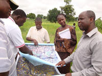
ICT Update Issue 53, February 2010. Source image: ICRISAT
- Log in to post comments